
Cold & Breezy to Start the Week
SPRINGFIELD, Mass. (WGGB/WSHM) - It was a frigid start this morning as many of us started off in the single digits and teens.
Watch for slick spots and allow for extra time for the commute this morning. Especially following the snow we got Sunday, might need to allow for more time to clear off the car and let it warm up.
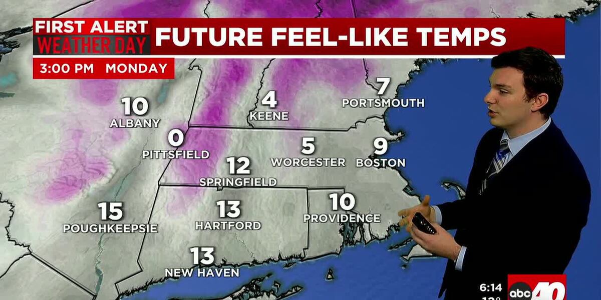
Today will be a cold day with a gusty breeze. Highs range in the 20’s, with winds gusting between 20-30 mph. This would put wind chills in the single digits and teens. Otherwise, we’ll see a mix of sun and clouds.
Tonight, winds relax and lows fall into the teens under partly cloudy skies.
Tomorrow, we’re mostly sunny and not as windy. Highs range in the lower 30’s, with a breeze at about 5-10 mph. Wind chills range in the 20’s. Still cold, but not as frigid.
As we push deeper into the week, we remain dry with more clouds on Wednesday, sun and clouds Thursday. Temperatures also start to trend a little milder. Both Wednesday and Thursday highs should range in the lower 40’s.
Your Next Weather Maker comes in on Friday. This will be caused by low pressure and a cold front. Ahead of the front, winds out of the south bring warmer temperatures ranging in the 50’s. We’ll see periods of rain, which may be heavy at times. Then as we get behind the front, colder air works in, and it turns breezy.
This weekend is looking dry and chillier. Highs on Saturday range in the 30’s, lower 40’s on Sunday under a mix of sun and clouds both days.
Copyright 2025. Western Mass News (WGGB/WSHM). All rights reserved.
Read the Original Article
This article was originally published by Western Mass News. Click below to read the full article on their website.
Visit Western Mass News