
Accumulating Snow from a Coastal Storm to End the Weekend
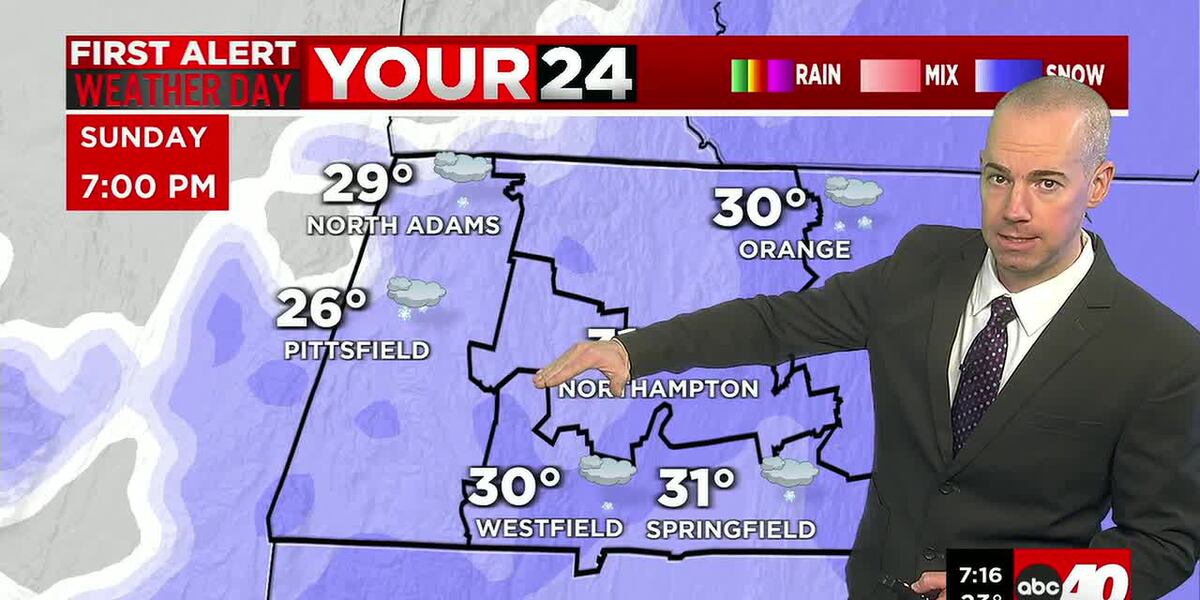
SPRINGFIELD, Mass. (WGGB/WSHM) - A coastal storm will pass just offshore into tonight, but be close enough to brush western Mass with more accumulating snow, especially into this evening. Periods of light snow will continue into the afternoon across much of New England as a coastal storm gets going just offshore. Snow will persist into the overnight and start to taper off into early Monday morning.
**A Winter Weather Advisory is in effect for the entire region until 7 AM Monday. Plan on slippery road conditions with the steadiest snow expected later this evening.**
This system will likely bring about 2-4 inches of snow across most of the region, with an isolated 5 inch amount possible. Higher amounts are expected towards central and eastern Mass where some heavier bands could set up.
On Monday, we will see seasonably cold conditions with a mix of sun and clouds ahead of an approaching arctic front. This front will move through on Monday night, bringing a brief shot of frigid arctic air to the region through about Wednesday morning. It will be blustery at times as well adding to that cold, so wind chills will become an issue.
Tuesday will be the coldest day of the week with daytime highs struggling to get much into the 20’s. It will continue to be blustery so a bitter cold day overall.
Into midweek, temperatures will begin to moderate slightly into Wednesday afternoon and particularly on Thursday into the mid 30’s. Our next weather maker comes in on Thursday with some snow showers and light accumulations possible. Another arctic shot arrives behind that system late week and into next weekend with another possible snow chance late in the weekend or early next week. Stay tuned!
Copyright 2026 Western Mass News (WGGB/WSHM). All rights reserved.
Read the Original Article
This article was originally published by Western Mass News. Click below to read the full article on their website.
Visit Western Mass News