
Breezy & Cool with a Mix of Sun & Clouds
SPRINGFIELD, Mass. (WGGB/WSHM) - After a beautiful day on Saturday, we had a gray, cooler and damp weather day Easter Sunday. At least it wasn’t a washout.
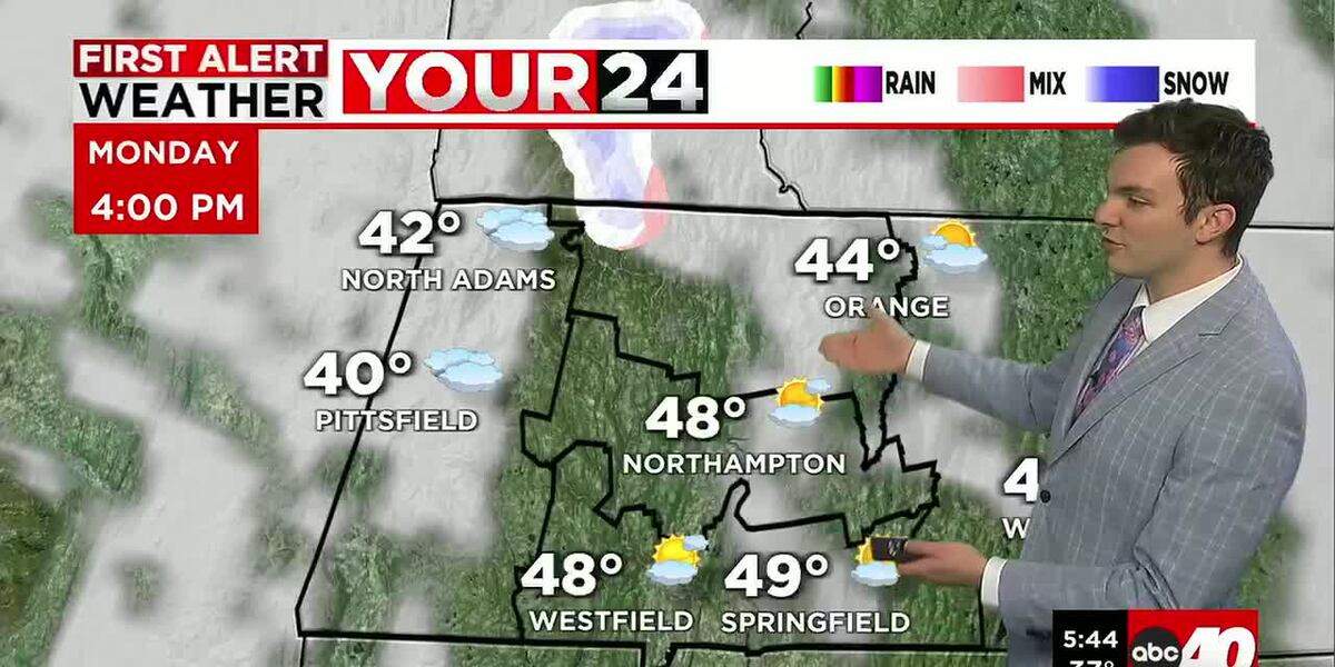
Improvements are here for today after a cold front passed through. Today we’ll see a mix of sun and clouds along with a gusty breeze. Winds out of the west and northwest at about 10-20 mph, gusts to 30 mph. Highs range in the middle and upper 40’s to near 50° for the Pioneer Valley, lower 40’s for the hills. That wind adding a little more of a chill.
Tonight, we’ll see clouds slowly build in, and it’s cold as lows fall into the upper 20’s and lower 30’s.
Tomorrow, weak low pressure passes to our north. This brings the chance for a few flurries, light snow showers and sprinkles throughout the day Tuesday, mainly in the morning. We’ll also see breaks of sun in between too. Not a washout, and we’re not expecting accumulation from any snow showers we see. Highs tomorrow range in the 40’s.
The remainder of the week is looking dry and sunny as high pressure takes control of our weather. Wednesday through Friday, we have mostly sunny skies with highs ranging in the 50’s. Low to mid-60’s by Friday.
Late Friday into Saturday morning, a few brief showers, then we dry out for Saturday.
This weekend right now is looking nice with sun and clouds both days. Highs ranging in the 60’s. Right now, next week is trending warmer.
Copyright 2026 Western Mass News (WGGB/WSHM). All rights reserved.
Read the Original Article
This article was originally published by Western Mass News. Click below to read the full article on their website.
Visit Western Mass News