
Briefly Mild, Then Arctic Cold Sets in for the Weekend
SPRINGFIELD, Mass. (WGGB/WSHM) - Watch for slick spots after we picked up a little snow last night. Most saw anywhere from a coating to an inch or two. Definitely not as cold as it was Wednesday morning!
Today will likely be the nicest day this week. Mix of sun and clouds with highs in the middle and upper 30’s to lower 40’s. In the late afternoon or early evening, a cold front comes through and brings the chance for a brief snow shower as the front moves through. Then behind it, the arctic cold rushes in.
Tonight, temperatures fall into the teens under partly cloudy skies with an increasing breeze.
Friday and especially the weekend, we will see the coldest air of the season with some dangerous cold.
Friday, we’ll have a mix of sun and clouds, highs only in the 20’s with wind chills in the teens.
**Extreme Cold Watches have been issued for Berkshire County, and the hills of Hampden Hampshire, Franklin Counties from 7pm Friday - 1pm Saturday**
Starting Friday night, temperatures will likely fall either side of 0°, with gusty winds, putting wind chills 10-30° BELOW 0°. Saturday and Sunday will see afternoon highs only in the teens, with wind chills below 0°.
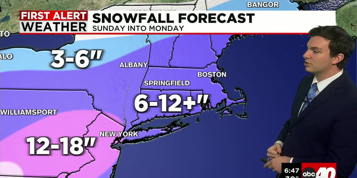
We’re also watching a major storm to our south for likely impacts to New England Sunday into Monday. Right now, confidence is increasing that we may see between 6-12 inches of snow.
Copyright 2026 Western Mass News (WGGB/WSHM). All rights reserved.
Read the Original Article
This article was originally published by Western Mass News. Click below to read the full article on their website.
Visit Western Mass News