
Chilly, Blustery & Cloudy Pattern Continues
SPRINGFIELD, Mass. (WGGB/WSHM) - Hopefully you were able to see the northern lights last night, though in some spots, clouds blocked out the view. We do have a chance to see the northern lights again, though we’ll be battling clouds once again tonight.
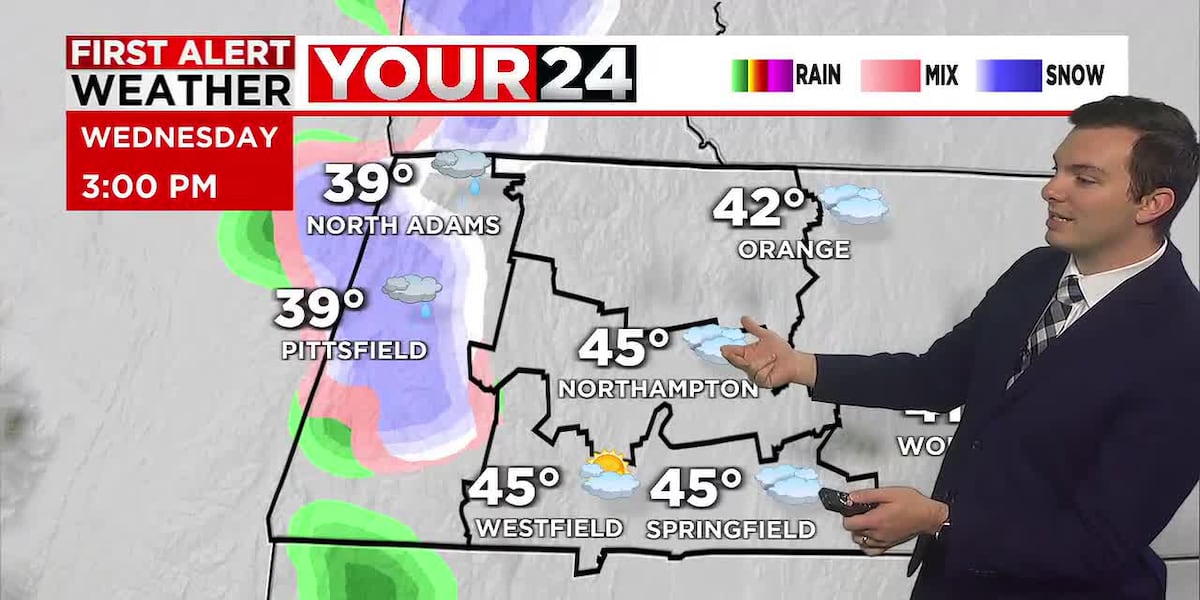
Today we started off with mainly cloudy skies and light winds. We are still under the influence of an upper-level low, which will bring us a lot of cloud cover today, with some breaks of sun, along with the chance for a few flurries or light snow showers. No accumulation is expected.
Winds today will also be lighter than what we saw on Tuesday. Ranging between 5-15 mph with an occasional gust to 20 mph. High temperatures will also get a few degrees warmer than Tuesday. Highs today range between 40-46°.
Tonight, we’re partly to mostly cloudy with the chance for a stray flurry or sprinkle. Lows fall into the middle 30’s with a light breeze.
Thursday we’re partly to mostly cloudy with a light shower or sprinkle chance. Highs ranging in the middle and upper 40’s.
By Friday and Saturday, we’ll see more sunshine working in and lighter winds. Highs still ranging in the 40’s.
Next, we’re watching the chance for a more widespread rain for Sunday. This may start as a brief rain and snow mix, but will quickly turn to justy a soaking rain. Temperatures in fact get milder, ranging in the lower 50’s. We’re still narrowing down details. This is the next weather maker we are watching closely.
Copyright 2025. Western Mass News (WGGB/WSHM). All rights reserved.
Read the Original Article
This article was originally published by Western Mass News. Click below to read the full article on their website.
Visit Western Mass News