
Chilly & Cloudy Thursday, Warmer Weather Returns to End the Week
SPRINGFIELD, Mass. (WGGB/WSHM) - Today, we started damp as we continued to deal with light showers from overnight, which slowly wind down.
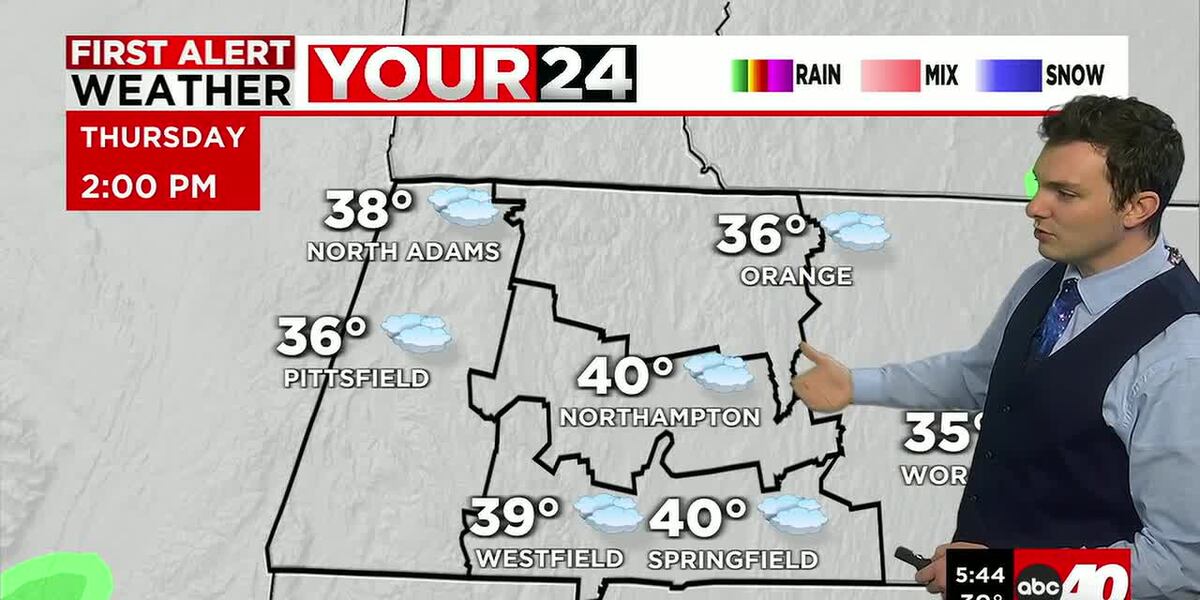
The rest of the day features cloudy skies and it’s chillier thanks to an easterly breeze. Highs are only expected to top of in the lower 40’s.
Tonight, we remain cloudy and cool with lows falling into the 30’s.
Friday, temperatures are getting milder once again as we get more of a south, southwesterly flow. We’re mostly cloudy in the morning with some sun in the afternoon with highs ranging in the 60’s. Hit or miss spot shower in the first half of the day if anything.
Saturday is also warm, highs in the lower and middle 70’s. Sun and clouds for many hours with the chance for a late day shower or storm.
Easter Sunday is looking mild and unsettled. Highs in the 60’s. We start dry and cloudy with increasing rain chances by around midday. A cold front will bring a period of soaking rain lasting into the evening.
Next week, once we are behind this front, our warm and unsettled pattern ends. Next week is trending dry with sunshine each day, and temperatures that are closer to normal if not a tick below normal at times, ranging in the 40’s and 50’s for daytime highs with chilly mornings.
Copyright 2026 Western Mass News (WGGB/WSHM). All rights reserved.
Read the Original Article
This article was originally published by Western Mass News. Click below to read the full article on their website.
Visit Western Mass News