
Falling temperatures this afternoon with gusty wind back tonight
Our First Alert Weather Day continues…
A Wind Advisory continues for all of Franklin, Hampshire, and Hampden Counties through 1am Saturday…
A High Wind Warning continues for Berkshire County through 1am Saturday…
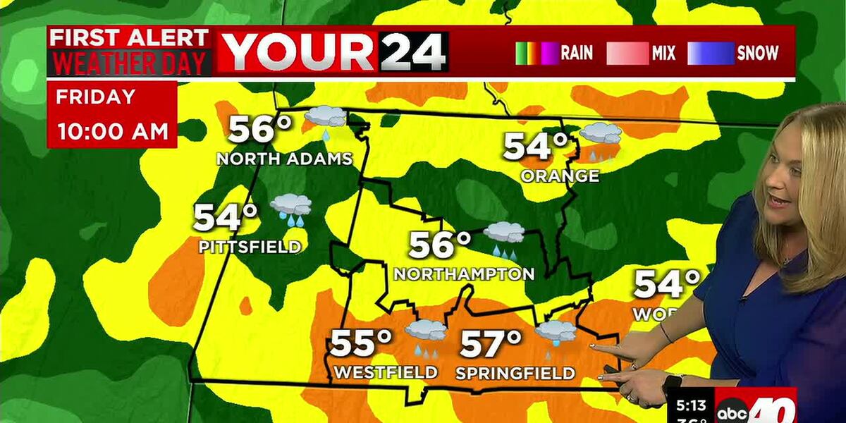
Warm, wet, and windy to wrap up the week! Temperatures soared into the upper 50s this morning, quickly breaking the previous daily record of 54 degrees, set in 1949 at Westover.
Rain has been heavy at times throughout the morning along with snow melt, so there is a lot of waterlogged roads out there.
Downpour and thunder chances subside early this afternoon as a cold front swings through and wind will ease for a few hours behind it. However, as a deep upper-level trough builds in, wind will pick back up again this evening and tonight. West-northwest wind gusts may top 40-50mph tonight and overnight, especially across the eastern slopes of the Berkshires.
Temperatures steadily fall this afternoon and evening, allowing for lingering showers to mix with and change to snow in the high terrain, then eventually the valley tonight. Rain and snow showers should end early in the valley with some partial clearing possible, but snow may linger in the Berkshires, bringing 1-2 inches. Temperatures fall into the 20s, so be wary of developing black ice.
Strong wind gusts should ease a little after midnight-especially in the valley. Strong gusts in the hills may hang on until near sunrise Saturday.
We wake up to sunshine Saturday, along with breezy, colder conditions. Wind eases by the afternoon, and clouds increase ahead of a mainly dry cold front. Sunday will stay chilly and turn blustery with west wind gusts back up to 20-30mph with mainly dry weather-and perhaps a stray rain or snow shower.
Colder air dives in Sunday night and Monday, which is looking breezy, bright and frigid with highs in the 20s to around 30!
A Clipper system may bring snow showers or a period of light snow Tuesday. Timing right now would bring light snow in for the morning or much of the day, so we may not get much for accumulations. But there is a chance… for an inch-which would give us a technical “White Christmas”! Drier weather is likely Wednesday and Thursday with some sun and seasonable temperatures.
Our forecast hints at some rain and snow showers Christmas night into Friday, but tough call this far out.
Copyright 2025. Western Mass News (WGGB/WSHM). All rights reserved.
Read the Original Article
This article was originally published by Western Mass News. Click below to read the full article on their website.
Visit Western Mass News