
First Alert Weather Friday with Snow Continuing Overnight
***It Remains a First Alert Weather Day.***
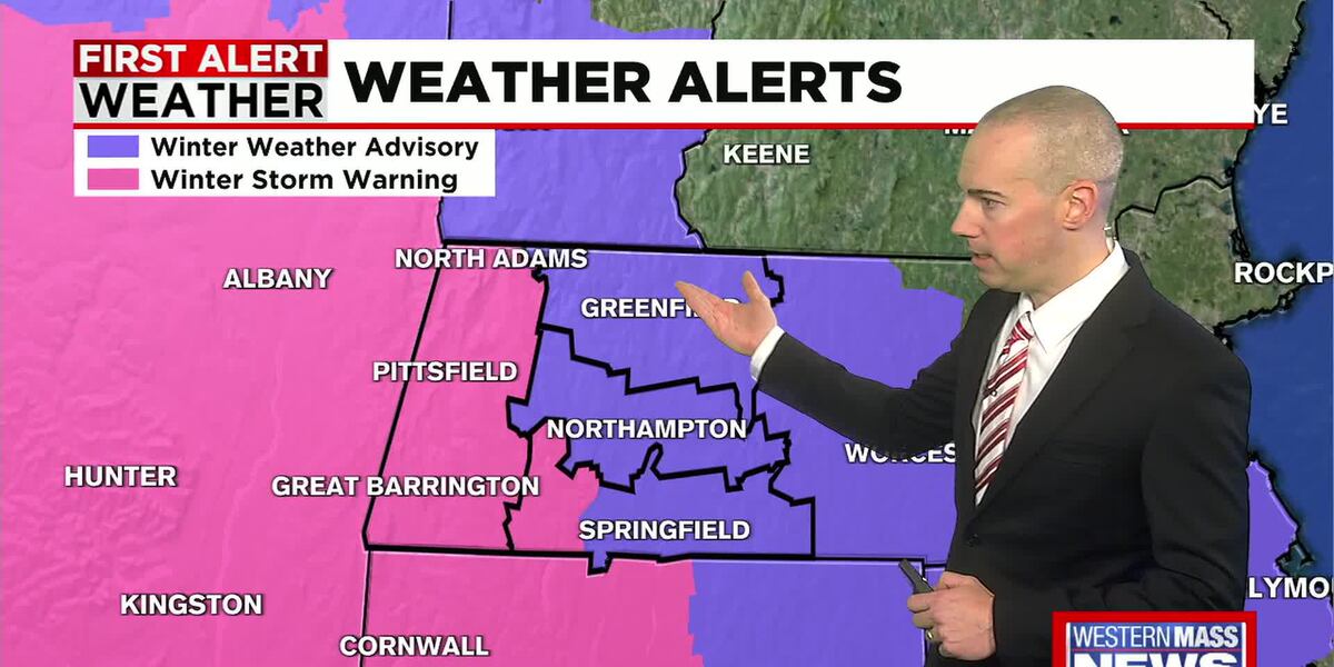
***Winter Weather Advisories are in effect for eastern Hampden, Hampshire and Franklin counties until 10 AM Saturday Morning.***
***A Winter Storm Warning is in effect for Berkshire County until 1 PM Saturday and western Hampden County until 10 AM Saturday.***
SPRINGFIELD, Mass. (WGGB/WSHM) - Tonight will feature moderate snow as a potent clipper system passes through our area. 2-4 inches is expected in Eastern Franklin County. For the rest of the Pioneer Valley, we can expect 3-6 inches of snow with slightly higher amounts possible in western parts of Hampden county. The jackpot area lies in Berkshire County where 5-8 inches of snow is expected. Lows will be in the teens and 20s. Because of the cold air in place, we can expect the snow to be light and fluffy, which aids in accumulation and will make it easier to shovel and plow.
Here are some snow totals into our newsroom as of 11 PM Friday:
- Southwick 3.5″
- Chicopee 3.0″
- Westfield 3.0″
- WGGB Studios 2.5″
- Hampden 2.3″
- W. Springfield 1.5″
The weekend is trending cold at this point with highs in the 20s and low to mid 30s. Snow will move out early Saturday morning, and we will see breaks of sunshine developing into the afternoon. Sunday will feature a mix of sun and clouds with increasing clouds in the afternoon. Our next weather maker moves in on Sunday night. This one will bring in some warmer air, especially aloft, so we will see some icy conditions to start with freezing rain before a turnover to all rain overnight. The winds will be light around 5 mph.
For Monday, the rain will continue as our low-pressure system passes us to the north. The low will bring in some warmer air as winds will be out of the WSW at 5-10 mph with gusts of 20-25 mph. The high temperatures as a result will be in the upper 30s and the low 40s.
The rest of the week will be breezy and will feature temperatures that are a little below average for this time of year. Highs will be in the 20s and the low 30s for the rest of the work week. We will see mostly dry conditions but can’t rule out a few flurries for Tuesday and Wednesday and even into New Year’s Day. We will also see breezy conditions continue out of the west at 5-15 mph.
Copyright 2025. Western Mass News (WGGB/WSHM). All rights reserved.
Read the Original Article
This article was originally published by Western Mass News. Click below to read the full article on their website.
Visit Western Mass News