
Frigid Cold Remains Locked in This Week
SPRINGFIELD, Mass. (WGGB/WSHM) - Another very cold start to the day for us, as many of us wake up to temperatures on either side of 0°.
Today will feature a mix of sun and clouds. Still cold, with highs in the lower to middle 20’s. Wind chills in the single digits below 0° once again.
The rest of this week is looking relatively quiet weather-wise. It remains very cold this week where daytime highs range in the teens with overnight lows in the single digits. Gusty winds at times may put wind chills well below 0° in the mornings at times this week.
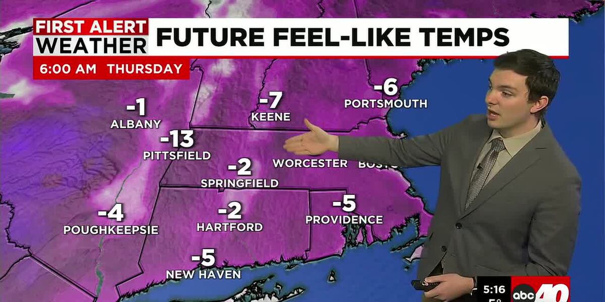
Looking like Friday will be the coldest with wind chills first thing in the morning, ranging between 10 to 30° below 0°. Even Friday afternoon, single digit and teens below 0° wind chills.
Watching the chance for more snow around Sunday. Right now, trends have a powerful storm offshore enough to where Western Mass gets grazed or misses out on snow.
Right now, it looks like the greatest impacts from heavy snow and gusty winds would be towards Eastern Mass, The Cape & The Islands, with a lower risk of impact in Western Mass. Regardless of if we get snow or not, it will still be windy.
Of course, we know the track can change and it can mean the difference between big snow and nothing. So, we’re watching, and stick with us for the latest on that.
Perhaps a return to more typical Early February temperatures next week.
Copyright 2026 Western Mass News (WGGB/WSHM). All rights reserved.
Read the Original Article
This article was originally published by Western Mass News. Click below to read the full article on their website.
Visit Western Mass News