
Frigid Start Monday, then Improvement This Week.
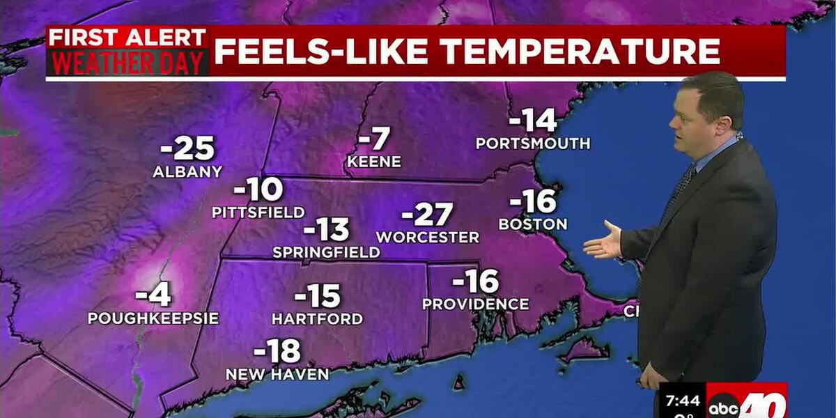
SPRINGFIELD, Mass. (WGGB/WSHM) - Cold Weather Advisories are in effect for all of western Mass through 10am Monday for wind chills as low as -15 for most, to -20 in the highest elevations.
Frigid temperatures linger through the Monday morning commute with many areas starting off on either side of 0 degrees. With a continued breeze, expect morning wind chills to be in the single digits and teens below 0.
Lots of sunshine throughout the day and brisk with a solid 10mph breeze for the afternoon with highs ranging in the 20s-much more temperate compared to this past weekend.
Temperatures turn more seasonable Tuesday, but an approaching Clipper will bring in more clouds and scattered snow showers by midday. This won’t be a big system by any means, but it may bring a half inch to inch and a half of snow by late Tuesday night. Roads may be slick for the Tuesday evening commute.
High pressure returns Wednesday, bringing gusty breezes, but temperatures are looking closer to normal with many hitting highs in the upper 20s to possibly mid-30s by the end of the week.
Valentine’s Day weekend right now is looking dry and seasonable to start, then there are hints of a storm system Sunday. As we are a week out, there’s no point in worrying now and models are really all over the place on if the storm even forms at all. So, for now, temperatures are looking seasonable and possibly even milder going into the 3rd week of the month.
Copyright 2026 Western Mass News (WGGB/WSHM). All rights reserved.
Read the Original Article
This article was originally published by Western Mass News. Click below to read the full article on their website.
Visit Western Mass News