
Gradual Improvements This Week Following a Frigid Weekend
SPRINGFIELD, Mass. (WGGB/WSHM) - A frigid start this morning as many wake up in the single digits on either side of 0°, with wind chills below 0°.
**Cold Weather Advisories remain in effect for all of Western Massachusetts through 10am**
Today, we’ll see mostly sunny skies with temperatures ranging in the 20’s with a light breeze.
Tonight, we’ll have building clouds. Those clouds will actually help keep temperatures above 0°.
Tuesday features mostly cloudy skies with a light breeze, and temperatures ranging in the low to mid-30’s.
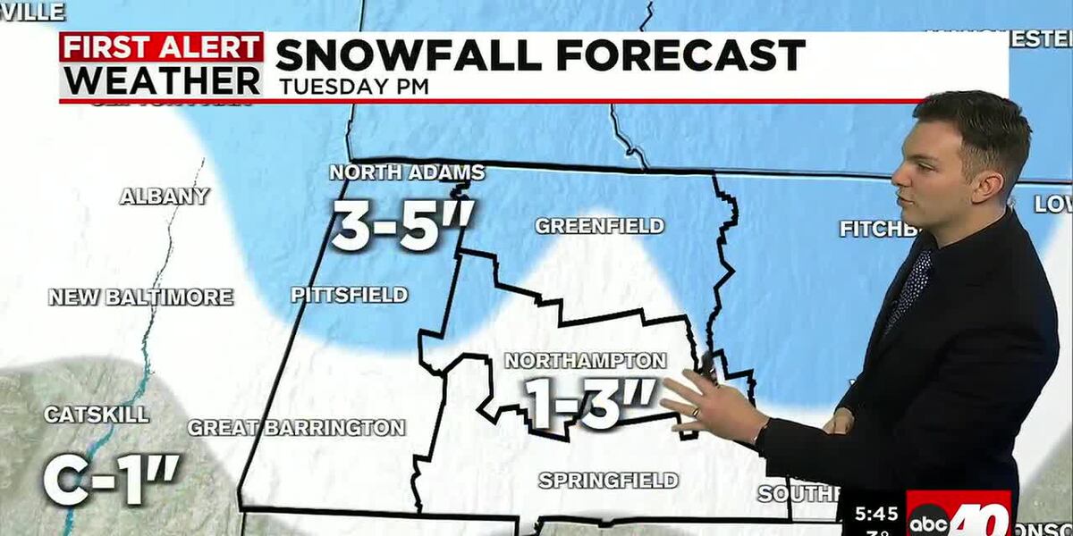
A clipper system passes through the region bringing periods of light snow Tuesday afternoon and evening. Likely to slow down the evening commute. We’ll see minor accumulations. 1-3″ in many valley locations, with around 3-5″ in the higher elevations.
Wednesday, it remains mostly cloudy and turns blustery. Highs remain in the low to mid-30’s with a few flurries around in the hills.
Quiet weather continues through the rest of the week. At least until Saturday, which is Valentine’s Day, we’re partly to mostly sunny with highs in the 30’s.
Next chance for wet weather looks to be around on Sunday. Some models hint at starting off as snow, with a change to rain as milder temperatures work in.
This would then be followed by a milder trend heading into next week.
Copyright 2026 Western Mass News (WGGB/WSHM). All rights reserved.
Read the Original Article
This article was originally published by Western Mass News. Click below to read the full article on their website.
Visit Western Mass News