
Gusty Winds and Cold on Tuesday
SPRINGFIELD, Mass. (WGGB/WSHM) - Today is a First Alert Weather Day due to wind and cold.
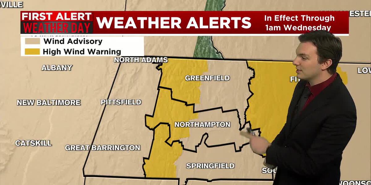
**A High Wind Warning is in effect for Western Hampden, Hampshire, and Franklin Counties until 1am Wednesday**
**A Wind Advisory is in effect for the remainder of Western Mass until 1am Wednesday**
Temperatures only range in the 20’s, with winds gusting between 35-45 mph in the Pioneer Valley, between 45-55 mph in the higher elevations.
Isolated wind damage or power outages are possible. Due to the high wind, we may also see some light snow showers in the Berkshire’s and hills from lake effect snow.
Winds slowly relax, but we remain breezy into Wednesday coming in at about 10-20 mph. We may see about 1-4″ of snow in the Berkshire’s over a 3-day period thanks to lake effect snow, and that flow out of the northwest.
New Year’s Eve, we’ll see a few light snow showers as a weak system moves through overnight, bringing some minor accumulations. Looking to see around a half inch to about 2 inches.
For the first few days of the new year, we’re looking dry, breezy and cold with daytime highs ranging in the 20’s, overnight lows in the teens. No indicators of any major snowstorms within the next 7-10 days.
Copyright 2025. Western Mass News (WGGB/WSHM). All rights reserved.
Read the Original Article
This article was originally published by Western Mass News. Click below to read the full article on their website.
Visit Western Mass News