
Intense Heat & Humidity Begins; Isolated Storms Possible Wednesday
SPRINGFIELD, Mass. (WGGB/WSHM) - It’s a warm and muggy start to the day today.
**An Extreme Heat Warning is in effect for Hampden, Hampshire, Franklin, and Berkshire Counties through Saturday.**
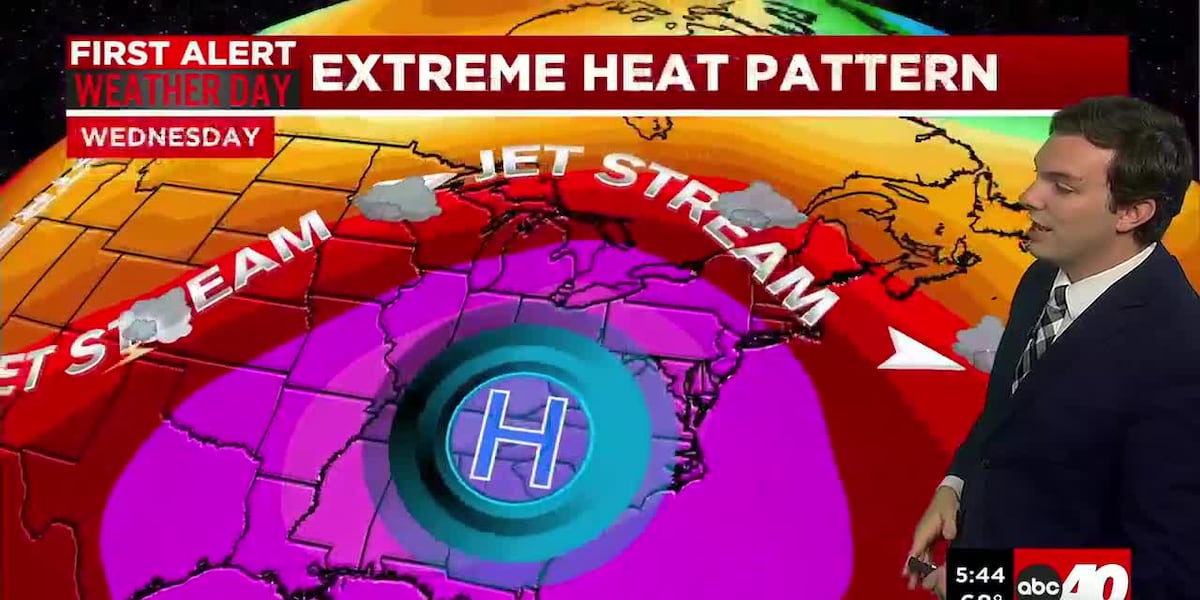
A dome of high pressure will set up over the Eastern U.S. this week sending the Jetstream well into Canada. For context, our normal high temperatures should be between 83-84° for the Springfield area.
Wednesday, Thursday, Friday, and Saturday are all First Alert Weather Days due to this extreme heat.
We’re talking high temperatures between 95-100° all four days. Very high humidity with dew points between 70-75°. This combination drives feels-like temperatures, or heat index values to 105°+.
Long term exposure to this level of heat will likely lead to heat-related illness. Limit your time outside and make sure you are drinking tons of water to stay hydrated. UV index will also range between 8-10 each day as well, so you can get sun burnt very fast.
Today will be partly sunny otherwise, with some afternoon isolated thunderstorms. Storms develop and travel around the heat dome, meaning for us in Western Mass, storms develop to our north and west and travel south into Western Mass.
The storm prediction center places most of Western Mass under a Slight risk for severe weather, a 2 out of 5 on the scale. This means some storms that roll through have the potential to be severe. Bringing damaging winds and heavy downpours.
Thursday and Friday will feature mainly sunny skies and will also be the hottest days, where highs are most likely to actually reach 100°.
4th of July weekend is also looking very hot as well. Saturday will continue with extreme heat. Highs between 95-100°. Partly sunny with a late-day shower or storm. We’ll have a clearer picture on any storm threats as we get closer.
Sunday will still be hot, but we starting to come down from the extreme heat. We’ll range in the upper 80’s and lower 90’s under partly sunny skies.
Next week, we look to see this extreme heat break down, and temperatures return closer to normal.
Copyright 2026 Western Mass News (WGGB/WSHM). All rights reserved.
Read the Original Article
This article was originally published by Western Mass News. Click below to read the full article on their website.
Visit Western Mass News