
Light Snow Followed by Bitter Cold This Weekend
SPRINGFIELD, Mass. (WGGB/WSHM) - Today, we’re mostly cloudy with highs in the 20’s. Overall quiet for Friday. An arctic front is on the way which brings gusty winds and frigid temperatures this weekend.
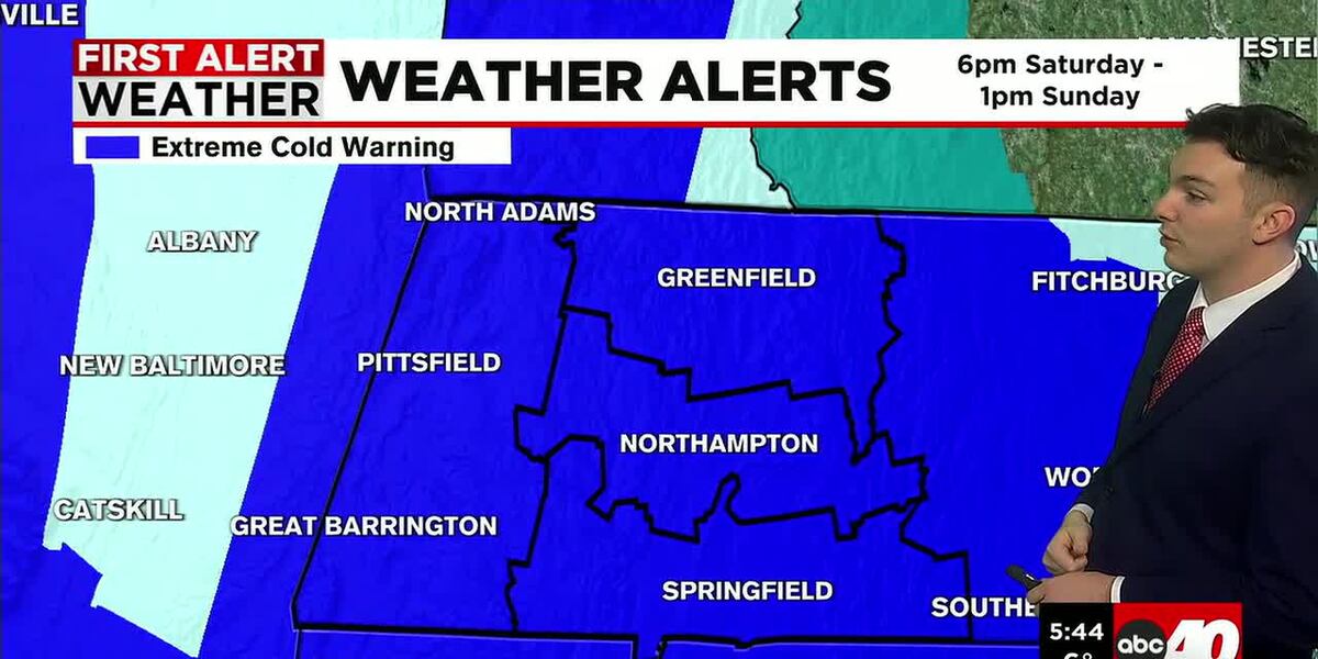
First Alert Weather Days for Saturday and Sunday.
**Extreme Cold Warnings have been issued for all of Western Massachusetts from 6pm Saturday through 1pm Sunday**
Ahead of the front, we may see some light snow showers or even a squall, leading to some minor accumulations. This looks to occur overnight and into Saturday morning. Looking like about 1-3″ at this point. Nothing major.
Behind the front, the weekend turns windy and frigid. Something we aren’t strangers to.
Highs on Saturday are achieved early in the day, in the lower 20’s. As the arctic air rushes in, temperatures are falling throughout the day.
Winds ramp up as well, gusting between 30-40 mph both Saturday and Sunday, putting wind chills between -15 and -35°.
Frigid air lingers into Monday, but winds are lighter so we’re starting to come out of the bitter cold.
Tuesday is looking sunny with highs in the upper 20’s to around 30°. Light snow possible for Wednesday, followed by temperatures trending closer to normal heading towards Valentine’s Day.
Copyright 2026 Western Mass News (WGGB/WSHM). All rights reserved.
Read the Original Article
This article was originally published by Western Mass News. Click below to read the full article on their website.
Visit Western Mass News