
Light Snow & Frigid Temperatures This Weekend
SPRINGFIELD, Mass. (WGGB/WSHM) - It was another cold start for us this morning, as we had clear skies and calm winds overnight.
Today, we’re once again featuring mostly sunny skies with fairly comfortable temperatures (For February standards). Highs range in the upper 20’s and lower 30’s with a light breeze.
Tonight, we’re cold once again with more clouds building in. Lows back into the single digits.
Tomorrow, we’re mostly cloudy with highs in the 20’s. Overall quiet for Friday.
An arctic front in on the way for Friday night. Ahead of the front, we may see some light snow showers or even a squall, leading to some minor accumulations. This looks to occur overnight and into Saturday morning. Looking like about 1-3″ at this point. Nothing major.
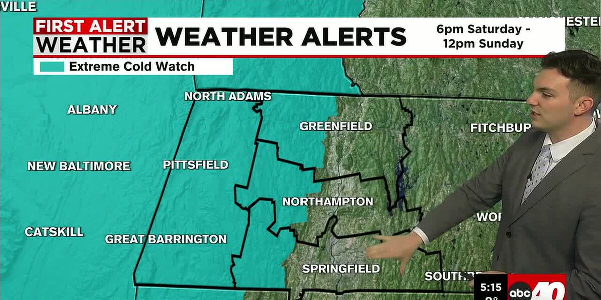
Behind the front, the weekend turns windy and frigid. Something we aren’t strangers to. Highs over the weekend will be stuck in the teens, with gusty winds, putting wind chills between -15 and -35°.
**Extreme Cold Watch has been issued for Berkshire County, and the hills of Hampden, Hampshire, Franklin Counties from
First Alert Weather Days for Saturday and Sunday.
Frigid air lingers into the first part of next week, before we start to trend milder by the middle and end of next week.
Copyright 2026 Western Mass News (WGGB/WSHM). All rights reserved.
Read the Original Article
This article was originally published by Western Mass News. Click below to read the full article on their website.
Visit Western Mass News