
Mild with a Mix of Sun & Clouds Thursday
SPRINGFIELD, Mass. (WGGB/WSHM) - Watch for icy spots from refreeze after the melting we had yesterday.
Today will be a nice day, especially for January standards. We’re partly sunny with highs in the lower to middle 40’s.
Tonight, temperatures fall back into the 20’s, so once again, watch for icy spots tonight and tomorrow morning due to refreeze. We will also see building clouds overnight and some patchy fog in some spots too.
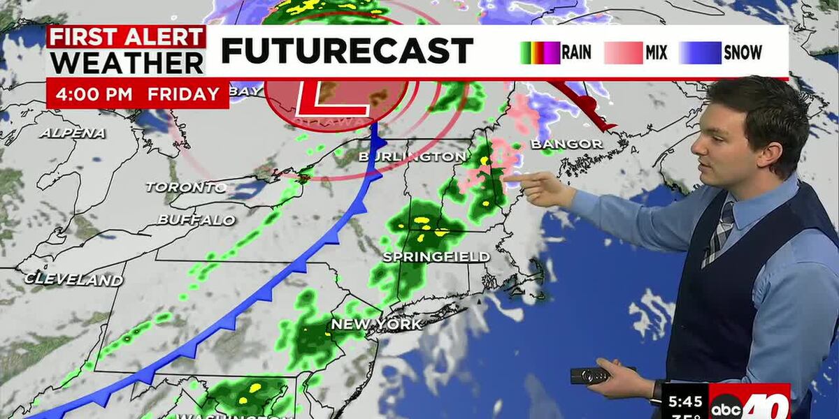
Friday, we begin dry with building clouds. Then low pressure passes to our north. This means we are on the warm side of low pressure. Shower chances increase by the afternoon, and we will likely see scattered showers into the evening. Temperatures should range in the 40’s, so this would come in the form of plain rain.
Saturday, we have another round of rain on the way. Likely in the afternoon and evening once again, lasting into the overnight. We would see periods of soaking rain with temperatures ranging in the 40’s. We may start as some wintry mix in our higher elevations. This low passes to our south, so some colder air tries to work in.
A few showers may linger into early Sunday morning, then we dry out and turn partly sunny for the rest of the day. Highs Sunday range in the lower to middle 40’s.
Next week is trending dry with highs ranging in the 30’s and 40’s through Wednesday. Then perhaps a cold snap by the end of next week.
Copyright 2026 Western Mass News (WGGB/WSHM). All rights reserved.
Read the Original Article
This article was originally published by Western Mass News. Click below to read the full article on their website.
Visit Western Mass News