
Periods of Rain Likely for Monday
SPRINGFIELD, Mass. (WGGB/WSHM) - We had a nice, crisp, refreshing start to our day today, but we are tracking a steady, soaking rain to start the week.
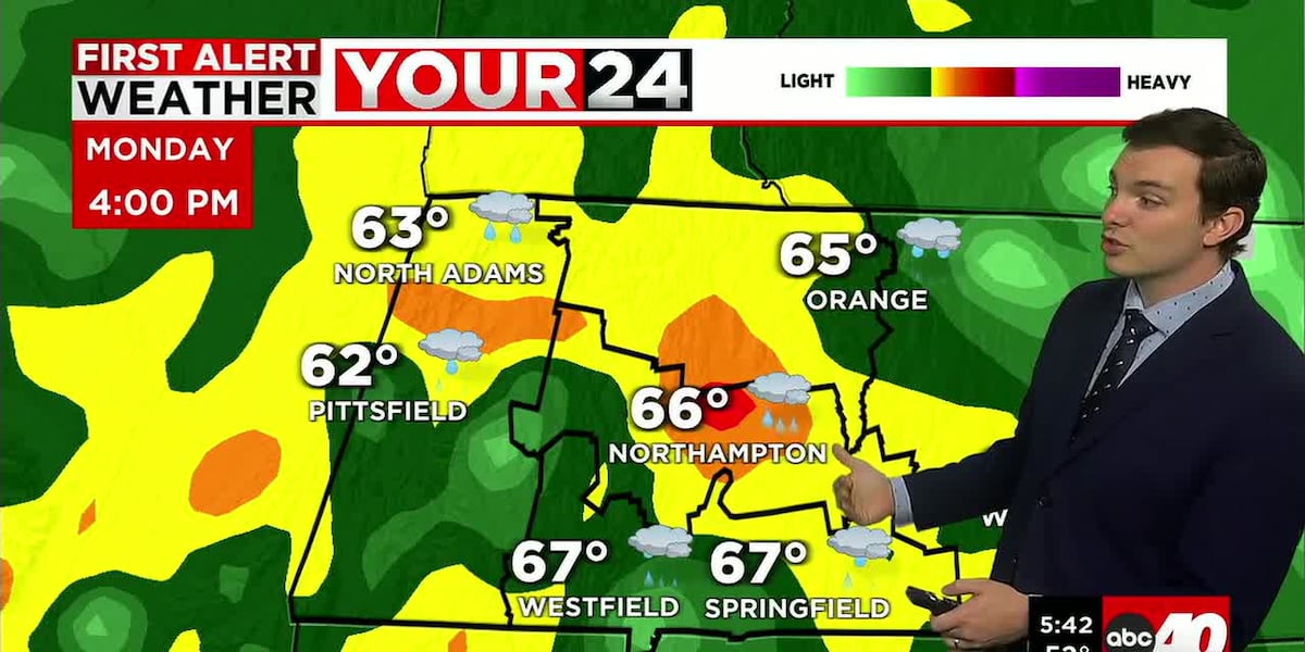
Low pressure passes just to the south of Western Mass and brings a period of soaking rain. Rain is likely to begin around mid-day, then last through the overnight. Rain is likely to fall at varying rates of intensity, and most areas can pick up around an inch of rain.
This is exactly what we need, as it has been very dry lately, and most of Western Mass is under a moderate drought. That’s a 2 out of 5 on the drought monitor’s scale.
Otherwise today, highs should range in the lower 70’s before rain gets going. Once rain begins, temperatures will fall into the 60’s. Not much of a breeze, light out of the south today. A slight muggy feel as dew points creep up into the 60’s.
Tonight, we’ll continue to see some scattered showers, perhaps even a few rumbles of thunder. Areas of fog by Tuesday morning. Lows fall into the lower 60’s.
Tuesday, we’ll start with areas of fog, a lot of clouds and perhaps a few leftover showers. Gradually throughout the day, as low pressure moves away, we’ll see some clearing. By the afternoon, we’re partly sunny and breezy. Winds may gust to 20 mph at times, and temperatures should range in the upper 70’s.
Wednesday, we’re mostly sunny, breezy and nice. Highs in the lower 80’s. Classic June stuff.
Thursday, we’re partly sunny most of the day with building clouds in the afternoon. An approaching cold front brings us our next chance for rain. This would be Thursday night into Friday. Periods of rain and perhaps a few thunderstorms are possible.
Copyright 2026 Western Mass News (WGGB/WSHM). All rights reserved.
Read the Original Article
This article was originally published by Western Mass News. Click below to read the full article on their website.
Visit Western Mass News