
Record Breaking Heat Likely Thursday
SPRINGFIELD, Mass. (WGGB/WSHM) - We got to 96° in Springfield on Wednesday. Not record breaking, but still very hot and humid. This stretch of extreme heat will continue today, in fact, it may end up being even hotter.
**An Extreme Heat Warning remains in effect for Hampden, Hampshire, Franklin, and Berkshire Counties through Saturday.**
This is caused by a dome of high pressure will set up over the Eastern U.S. this week sending the Jetstream well into Canada. For context, our normal high temperatures should be between 84-85° for the Springfield area.
Thursday, Friday, and Saturday remain First Alert Weather Days due to this extreme heat.
We’re talking high temperatures between 95-100° all 3 days. Very high humidity with dew points between 70-75°. This combination drives feels-like temperatures, or heat index values to 105°+.
Long term exposure to this level of heat will likely lead to heat-related illness. Limit your time outside and make sure you are drinking tons of water to stay hydrated. UV index will also range between 8-10 each day as well, so you can get sun burnt very fast.
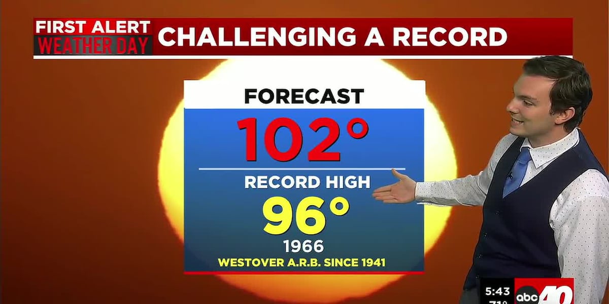
Today and tomorrow feature mainly sunny skies and will also be the hottest days, where highs are most likely to actually reach 100°.
4th of July weekend is also looking very hot as well. Saturday will continue with extreme heat. Highs between 92-98°. Partly sunny with afternoon thunderstorms.
Sunday will still be hot, but we starting to come down from the extreme heat, and it’s less humid. We’ll range in the upper 80’s and lower 90’s under partly sunny skies.
Next week, we look to see this extreme heat break down, and temperatures return closer to normal.
Copyright 2026 Western Mass News (WGGB/WSHM). All rights reserved.
Read the Original Article
This article was originally published by Western Mass News. Click below to read the full article on their website.
Visit Western Mass News