
Warm & Sunny for the Rest of the Week
SPRINGFIELD, Mass. (WGGB/WSHM) - We has a cool start to our Wednesday, though not as chilly as Tuesday morning was.
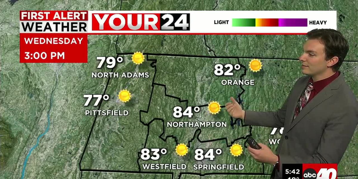
Today we have another very nice day on the way. High pressure continues to control our weather pattern, so this will bring mostly sunny skies today. Highs range in the middle 80’s with low humidity and a light breeze.
Tonight, we’re mostly clear and cool with lows falling into the 50’s.
The remainder of the week is also looking nice. We could also be looking at our second heatwave of the year.
Thursday and Friday are both partly to mostly sunny while also getting warmer. Highs in the upper 80’s and lower 90’s. While it gets hotter, humidity remains very manageable.
A cold front comes through over the weekend. Saturday is looking partly sunny, hot and getting muggier ahead of that front. Highs in the upper-80’s to low-90’s. The front may hold off, leading to a warmer and drier day Saturday, with shower and storm chances increasing by the evening.
As the front slowly pulls away, leftover showers may linger around for Sunday. It’s also muggy as the front is passing, especially in the morning, then turning less humid with highs in the 70’s.
Next week is trending seasonable and dry. Daytime highs ranging in the upper 70’s and low to mid-80’s.
Copyright 2026 Western Mass News (WGGB/WSHM). All rights reserved.
Read the Original Article
This article was originally published by Western Mass News. Click below to read the full article on their website.
Visit Western Mass News